Tropical Storm “Mario” FUNG-WONG

WEATHER BULLETIN NUMBER EIGHT
TROPICAL CYCLONE WARNING: TROPICAL STORM “MARIO” (FUNG-WONG)
ISSUED AT 5:00 PM, 19 SEPTEMBER 2014
(Valid for broadcast until the next bulletin to be issued at 11 PM today)
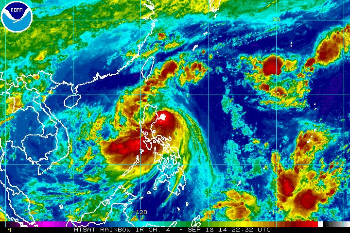
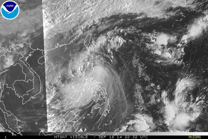
TROPICAL STORM “MARIO” HAS SLIGHTLY WEAKENED WHILE TRAVERSING BABUYAN CHANNEL.
Location of eye/center:
At 4:00 PM today, the center of Tropical Storm
“MARIO” was estimated based on radar and other
available data at 70 km Northeast of Laoag City
(18.7 ° N, 121.0 ° E).
Strength: Maximum sustained winds of 75 kph near the center and
gustiness of up to 90 kph.
Movement: Forecast to move West Northwest at 19 kph.
Forecast Positions:
By tomorrow afternoon it will be at 216 Northwest of
Itbayat, Batanes and by Sunday afternoon , it will be at
499 km North Northeast of Itbayat, Batanes or
outside the Philippine Area of Responsibility (PAR).
Source: DOST PAGASA